Back to blog
Journal

Most drone programs start the same way. You buy a platform, fly with the camera it came with, and figure out the rest as you go. That works, until you run a mission where the standard camera isn't enough, and you realize there was a sensor or payload that could have changed the outcome.
Here's a simplified breakdown of the most common drone sensors and payloads, what they detect, and who actually needs them.
RGB / Visible Light
The default. High-resolution color imagery, the same way your eye sees it. Great for mapping, documentation, orthomosaics, and any mission where a clear visual record is the goal. It's not going to find a missing person in dense trees at 2am, but it's the workhorse of most drone programs for good reason.

Thermal / Infrared
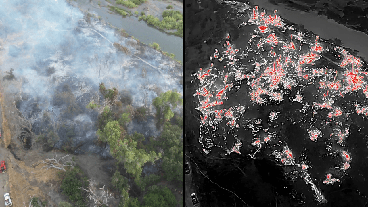
If your agency is operating a drone without a thermal camera, that's the gap worth closing first. These sensors detect heat rather than light, which means they work in total darkness, cut through heavy smoke, and pick up on body heat that a standard camera would never see. For most public safety operations, nothing else on this list comes close to the immediate operational return.
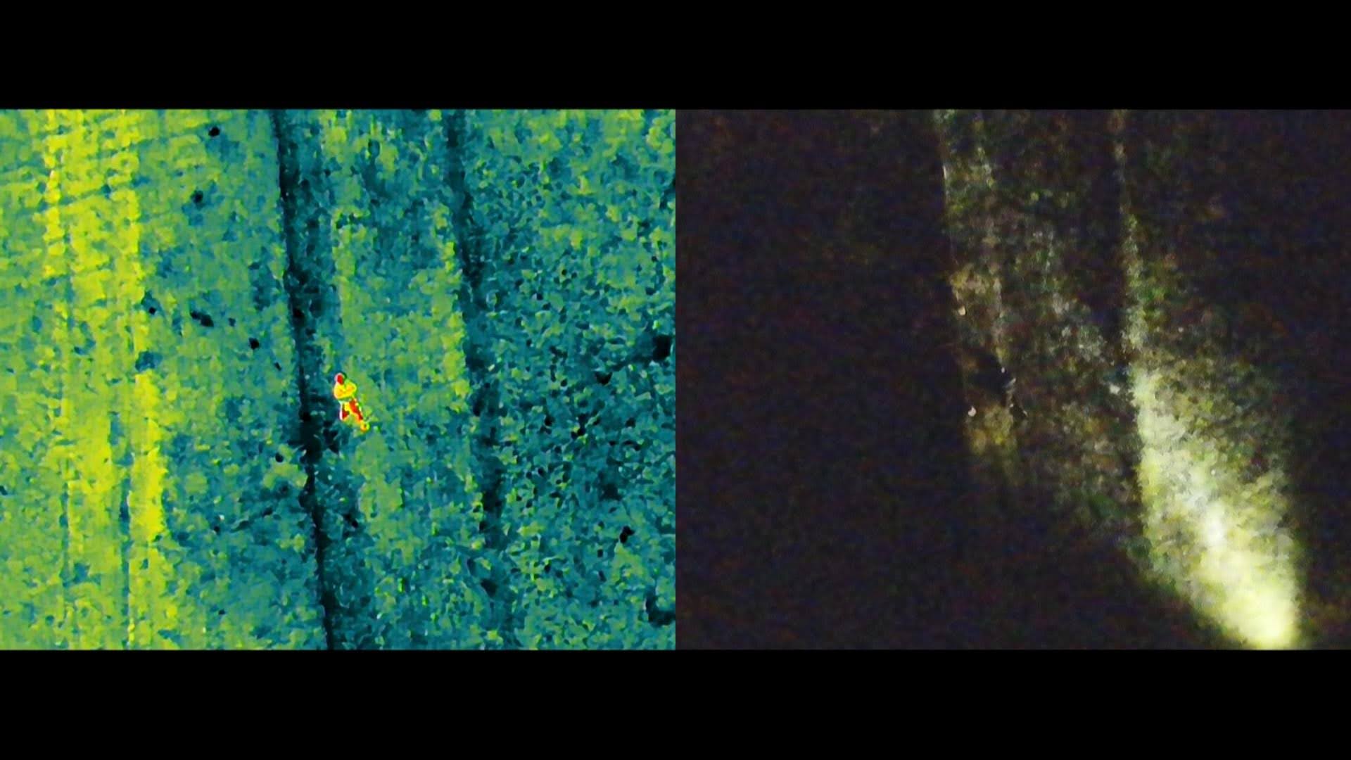
For firefighters, thermal gives you scene size-up at a glance of fire behavior, intensity, and perimeter mapping without putting anyone in proximity to the smoke. It finds the smoldering embers that look extinguished from the air but aren't, before they reignite. For search and rescue, any body heat or engine warmth becomes immediately visible in conditions where a visual search would take hours. For law enforcement, it provides critical overwatch during night operations and subject tracking without dependence on aviation support.
If you're only going to add one sensor to your program, this is it.
Multispectral
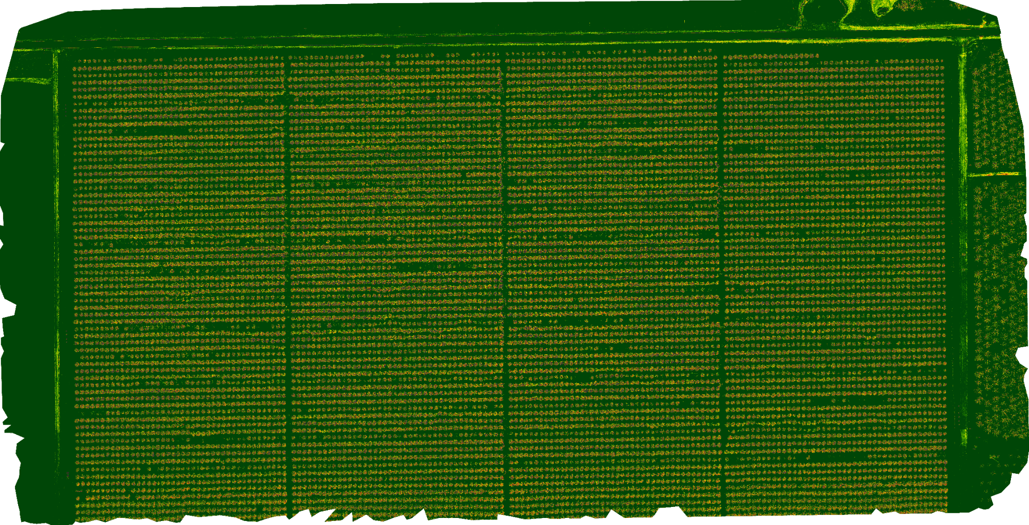
Captures wavelengths of light beyond what the human eye can see, primarily to assess vegetation health and to locate unwanted weeds in a field. Can be used to create prescription maps for large spraying drones for precise pesticide applications. Big in agriculture and land management, but less relevant for most emergency response agencies. If you're monitoring post-fire recovery or managing a large land area, this is worth a look. Otherwise, probably not your next purchase.
Zoom / Optical Telephoto
Lets you observe a scene from a significant standoff distance without the drone needing to be overhead. Law enforcement uses this for surveillance, tracking, and active threat situations where you want eyes on a location without announcing your presence. The best payloads combine zoom and thermal in one gimbal.
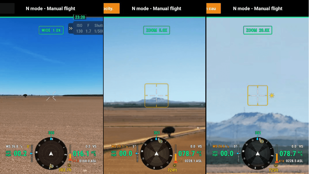
Wide View, 5x Zoom, and 20x Zoom Views of a distant Hilltop.
Laser Rangefinder
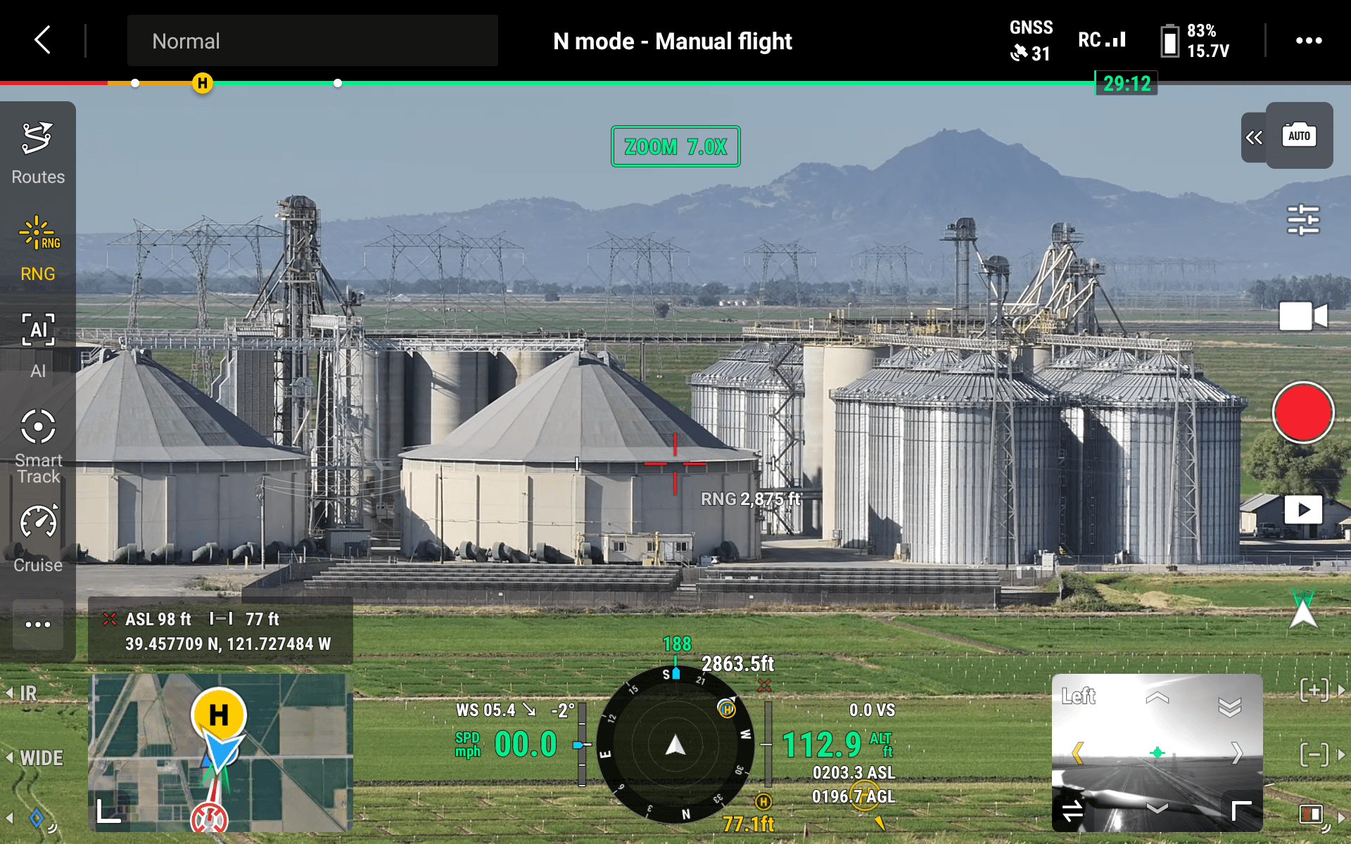
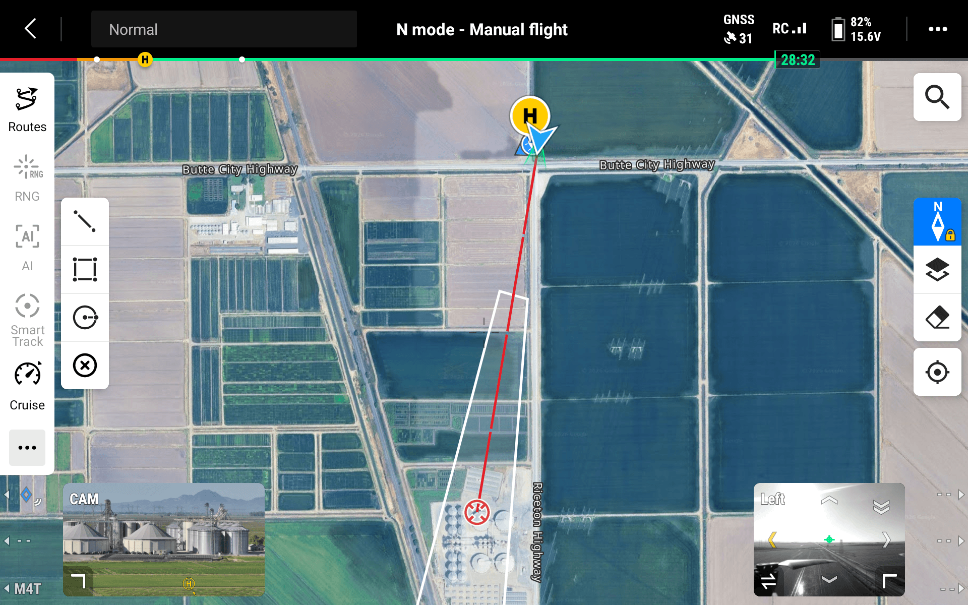
Most drone sensors tell you what something looks like. A laser rangefinder tells you exactly where it is. Increasingly common on platforms like the Matrice 4 and Matrice 30, laser rangefinders give operators the precise GPS coordinates, elevation, and map location of any target the drone is pointed at in real time, without needing to land or post-process anything. For a SAR team that just located a subject in dense terrain, that's the difference between describing a general area over radio and dropping a pin that ground crews can navigate to immediately. For a fire crew identifying a hotspot through smoke, it means command gets actionable coordinates, not an approximation.
The rangefinder is also what makes aerial target handoff possible. When a drone operator needs to pass a location to another aircraft, a ground team, or an incident commander working off a map, exact coordinates eliminate the communication gap that costs time in the field. It's a small addition to a payload lineup, but precise location data is often the most valuable thing a drone can deliver.
LiDAR
Fires laser pulses to build a precise 3D map of terrain and structures, and unlike cameras, it can see through tree canopy. Is also used on newer models of agricultural spraying drones for enhanced obstacle detection The data quality is exceptional, especially for elevation mapping in forested areas. The catch: LiDAR payloads are expensive and require specialized processing. Most frontline operations don't need it, but if your agency does survey-grade mapping, accident reconstruction, or manages forested land, it's worth understanding.
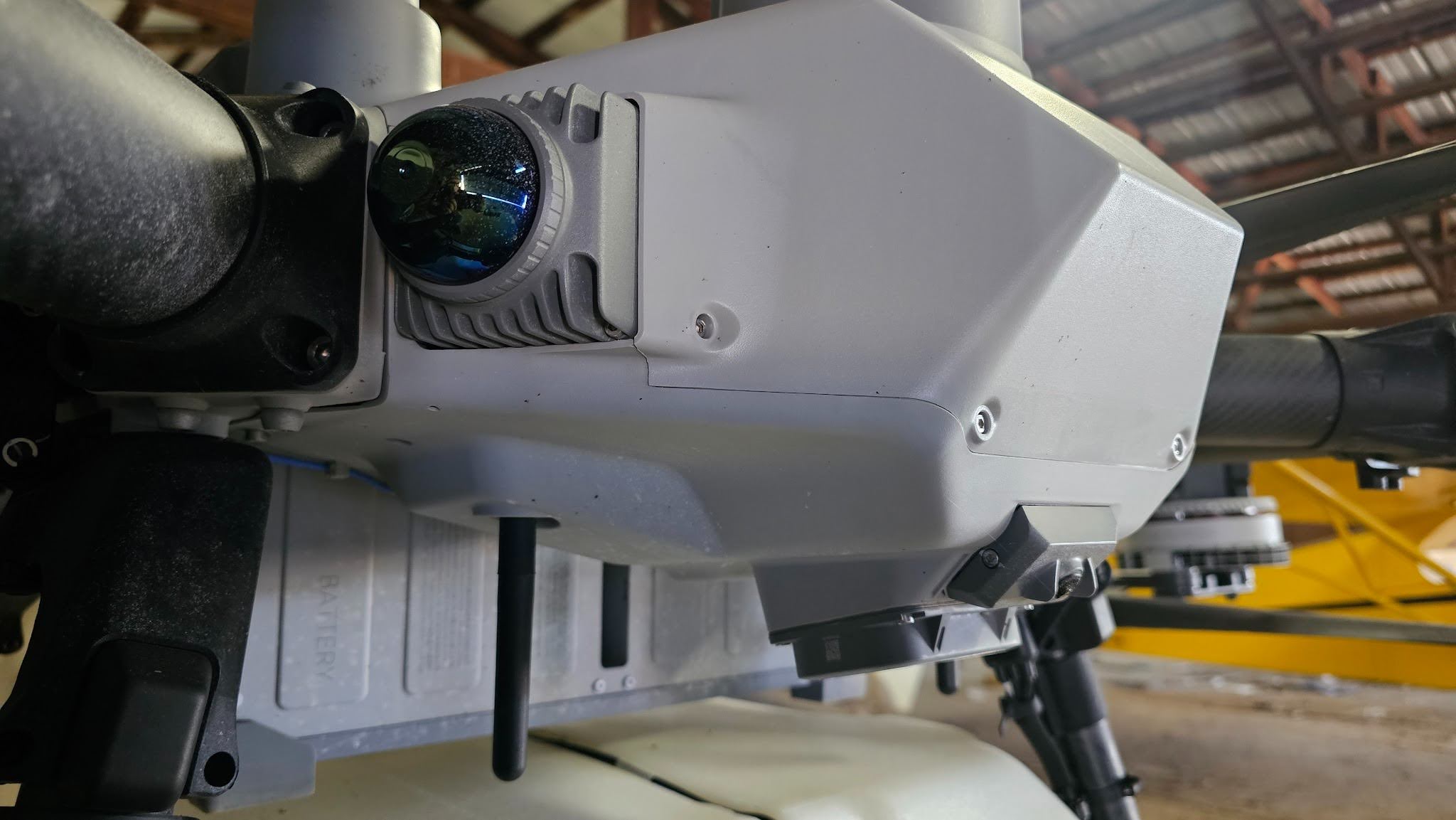
LiDAR sensor on a DJI Agras T100
Gas Detection
Mounts a chemical detection sensor array on the drone to identify the presence and concentration of specific gases such as methane, CO, hydrogen sulfide, and others relevant to fire, hazmat, and industrial monitoring teams. Allows you to send the drone into a potentially hazardous atmosphere before your people. For agencies responding to pipeline corridors, industrial facilities, frequent hazmat calls, or methane leak detection, it's a meaningful capability.
Spotlight and IR Illuminator
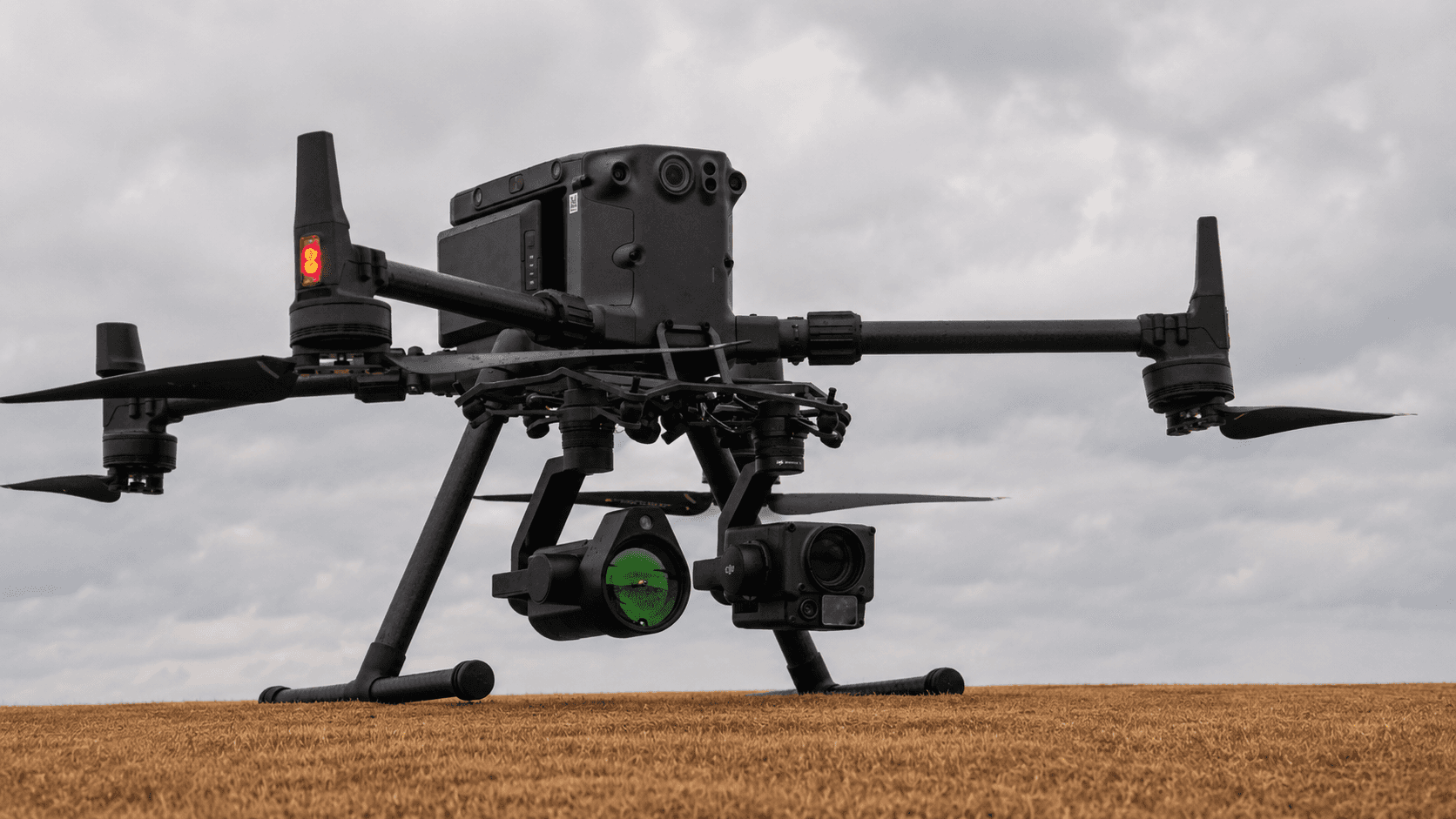
A common add-on payload on public safety drones. A high-powered light, either visible or infrared, mounted on the drone. Visible spotlights illuminate terrain for ground teams during night operations. IR illuminators are invisible to the naked eye but show up clearly on night-vision equipment, which is useful for tactical operations where you don't want to light up your position. High power draw means shorter flights, but for night SAR or law enforcement operations, it's a practical force multiplier.
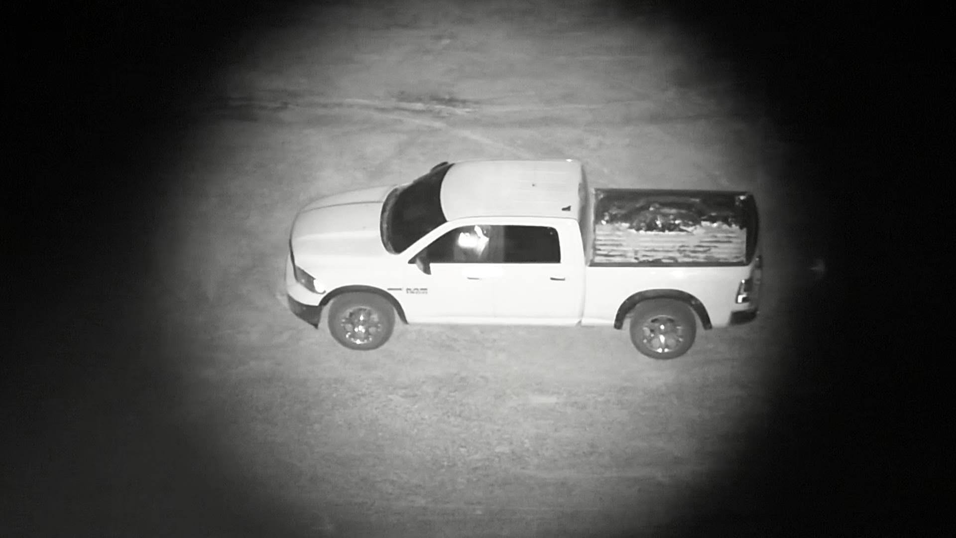
A NIR Spotlight on a moonless night.
Loudspeaker
Another widely used add-on payload for public safety platforms is a drone-mounted PA system. In SAR, you can broadcast to a located but unreachable subject, tell them to stay put, and guide them toward rescuers. In an evacuation, you can direct civilians across terrain faster than any ground-based option. In a barricade situation, it gives you a standoff communication option. Simple concept, real operational value. Oftentimes these speakers can be combined with a spotlight.
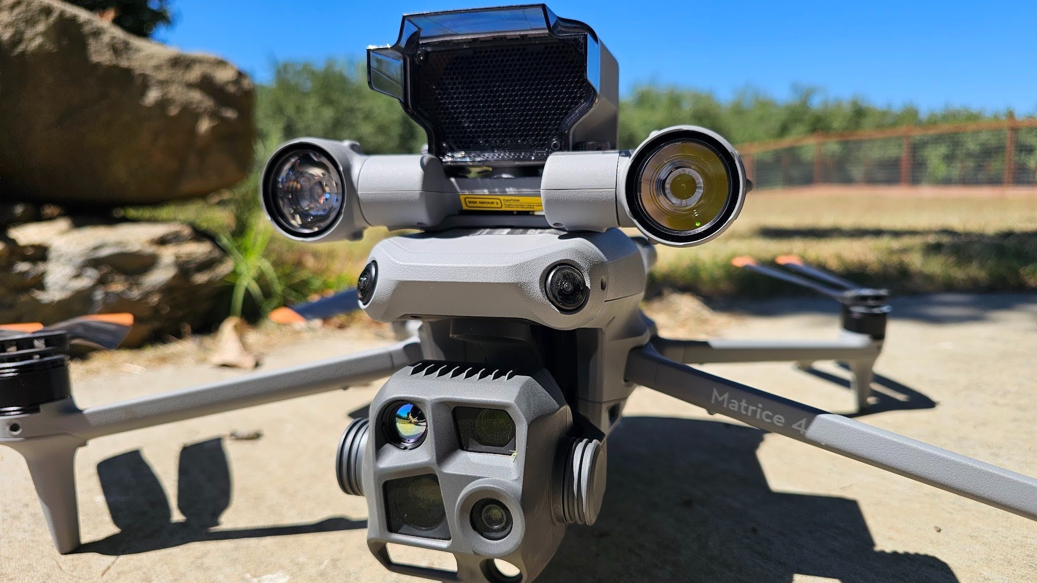
A DJI Matrice 4T equipped with a Loudspeaker and Spotlight combination.
Cargo System
There are two main ways that cargo is transported by drone. The first is a release mechanism that mounts to the underside of a drone and is controlled by either the onboard UI or by manipulation of the auxiliary lights, while the second is a dedicated cargo system built specifically for the model of drone that utilizes a winch or a cargo hold. These systems let the drone deliver a payload such as a survival kit, flotation device, GPS beacon to a precise location on command. Used in SAR to support a located subject while ground teams move in, and in water rescue to deploy flotation before a boat arrives. Weight limits and FAA regulations around dropping objects from aircraft apply, but agencies are finding practical uses.

A Drone Skyhook mounted underneath a Mavic 3 series Drone.
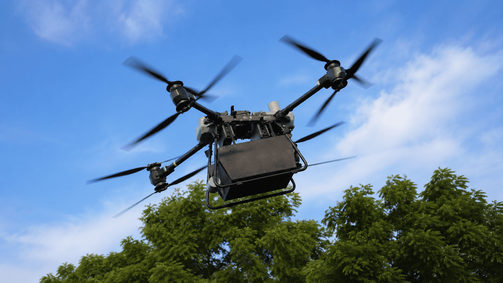
A DJI Flycart with a large cargo hold.
Parachute Systems
Mounted above the drone rather than below, parachute systems are a safety-focused payload worth knowing about. In the event of a critical failure mid-flight, a parachute deploys to slow the descent and reduce risk of injury or damage on landing. This is particularly relevant for agencies operating drones over crowds, populated areas, or large public events where an uncontrolled descent would pose a serious safety concern.
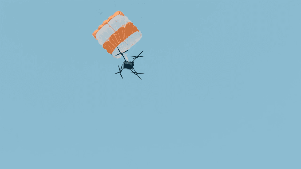
A DJI Flycart 30 with an integrated parachute system. Source: DJI
RTK / PPK GPS
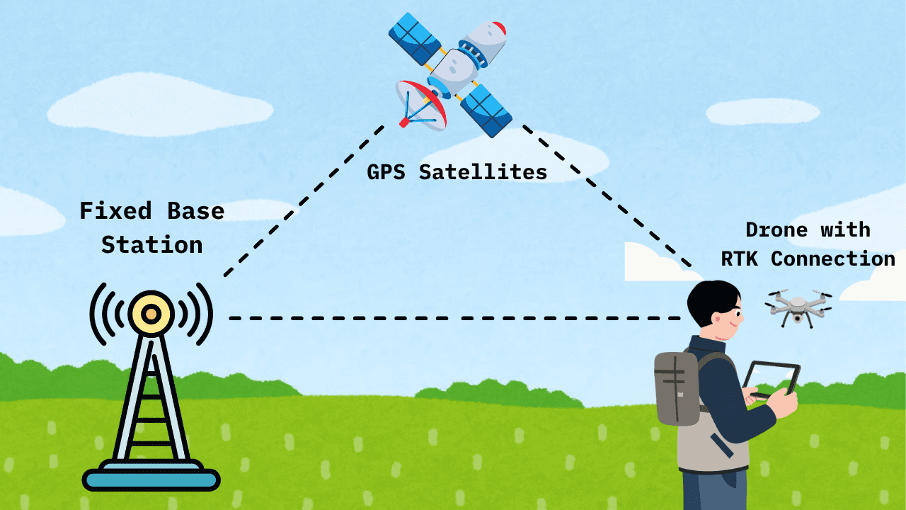
RTK stands for Real Time Kinematics, while PPK stands for Post-Processed Kinematics. Not a sensor exactly, more of a GPS enhancement that takes your positioning accuracy from the standard 1–3 meter range down to centimeters. This is done by creating a triangulated connection between GPS satellites, a Drone with RTK capabilities, and an RTK base station mounted in a fixed position. Heavily used in agricultural purposes for precise spraying with drones and field work with tractors. Relevant to first responders when your data needs to be survey-grade: accident reconstruction, legal documentation, infrastructure inspection, or precise alignment with existing GIS datasets. For most operational missions, standard GPS is fine. When it isn't, RTK/PPK is the answer.
The Right Sensor for Your Operation
You don't need all of these. The question is which one closes the biggest gap in what you're already doing. For most public safety agencies, the answer is thermal. For law enforcement with surveillance needs, zoom. For precision documentation, RTK/PPK. For specialized hazmat response, gas detection. And regardless of which sensors you're running, the data is only as useful as what you do with it once the drone lands.
Questions about integrating sensor data into your operations? Reach out at hello@mapnova.com.
Start for free today.
Craft the future. Respond to the present.