
Drone Data Analysis that Helps You Shape the Future
Drone Data Analysis that Helps You Shape the Future
Drone Data Analysis that Helps You Shape the Future
100% free to start. No credit card required.
Drone Data Analysis that Helps You Shape the Future
100% free to start. No credit card required.
TRUSTED BY


Live stream, orthomosaics, video, and thermal imagery, we make it simple.
Our fast, intuitive, and reliable software simplifies complex data analysis, enabling you to process drone data with ease and enhance your team’s entire response.
Crafted for the work you do.
Crafted for the work you do.
Crafted for the work you do.
Designed for drones
Simple workflows that transform your drone data into actionable insights and powerful products.
Co-create in one space
Bring your team, your clients and your end-users into a unified, collaborative workspace.
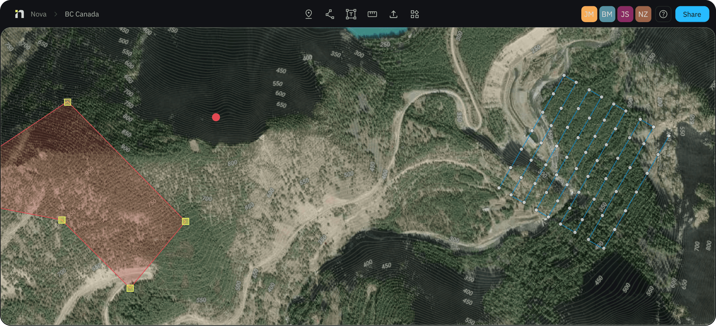
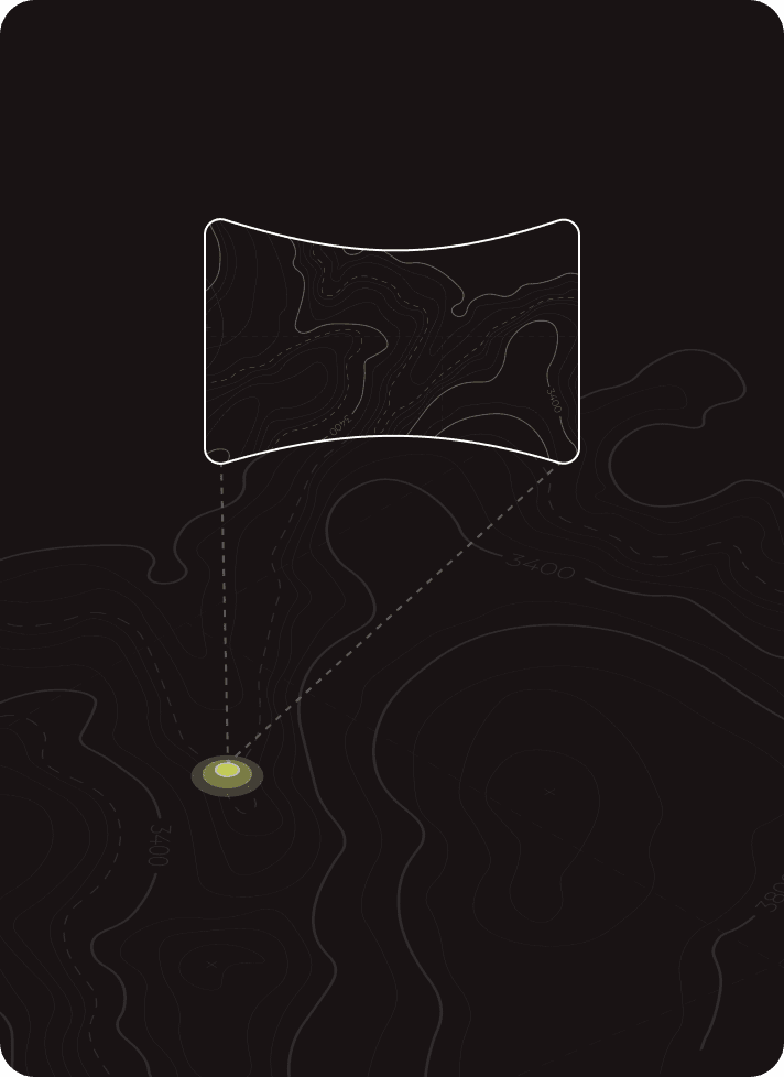
Mapping, simplified
Our software enables you to effortlessly generate meaningful maps and create mission-ready objectives.
Co-Create in one space.
Co-Create in one space.
Co-Create in one space.
Build a unified, real-time common operating picture that keeps your team aligned. Whether responding to an emergency or planning long-term operations, stay up-to-date and keep everyone on the same page.

Features
Live Stream

Connect. Share. Stream.
Real-time situational awareness to everyone through a secure link. Empower decision-makers to act and make better-informed decisions with confidence.
Your video streams are automatically saved, stored, and available after for review and post-action assessments by you and all of the collaborators in your Workspace.
Live Stream
Connect. Share. Stream.
Real-time situational awareness to everyone through a secure link. Empower decision-makers to act and make better-informed decisions with confidence.
Your video streams are automatically saved, stored, and available after for review and post-action assessments by you and all of the collaborators in your Workspace.
Orthomosaics
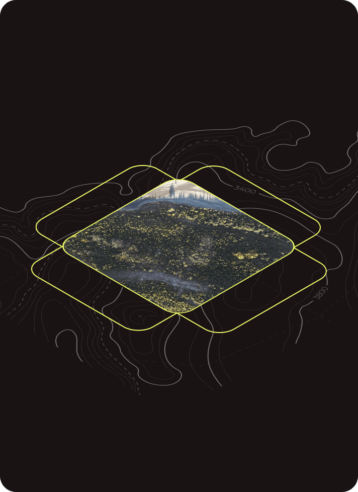
High-resolution imagery layers, fast.
Stitch together images captured from your drone, helicopter or plane into a rich, detailed mosaic that drapes over your map and can be used to drive decisions, inform management and provide insightful visualizations to field crews.
Layer orthomosaics on top of each other for pre and post assessments, annotate layers using our point, line and polygon tools and export the raw files or a georeferenced PDF map.
Orthomosaics
High-resolution imagery layers, fast.
Stitch together images captured from your drone, helicopter or plane into a rich, detailed mosaic that drapes over your map and can be used to drive decisions, inform management and provide insightful visualizations to field crews.
Layer orthomosaics on top of each other for pre and post assessments, annotate layers using our point, line and polygon tools and export the raw files or a georeferenced PDF map.
Panorama
Capture every angle.
Panorama
Capture every angle.
Panorama
Capture every angle.
Panorama
Capture every angle.
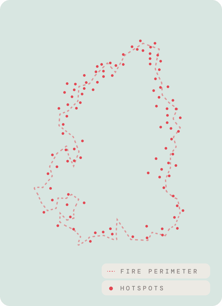
Automated Hotspot Detection
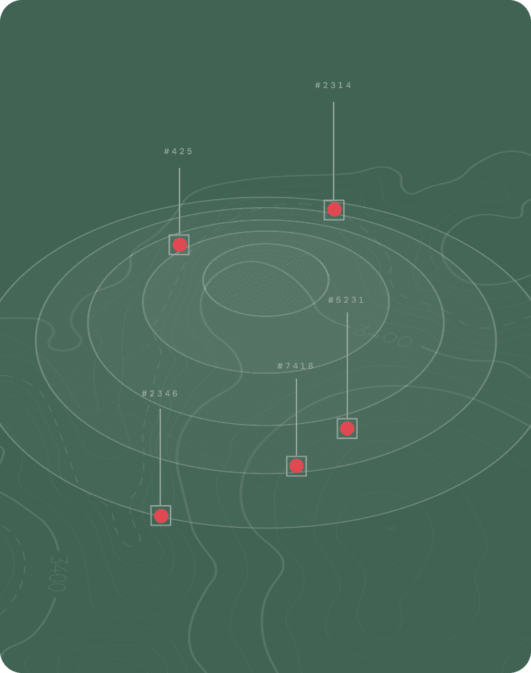
See fire like never before.
Our AI model is trained to detect and locate heat, helping you identify remaining hotspots and deploy resources exactly where they're needed.
Filter by distance to perimeter, hotspot temperature, and size, then export your hotspots on geo-referenced PDF maps. Avenza-friendly and compatible for crews in both online and offline environments.
Automated Hotspot Detection
See fire like never before.
Our AI model is trained to detect and locate heat, helping you identify remaining hotspots and deploy resources exactly where they're needed.
Filter by distance to perimeter, hotspot temperature, and size, then export your hotspots on geo-referenced PDF maps. Avenza-friendly and compatible for crews in both online and offline environments.
Colorfinder

Find the clues that count.
Enhance your ability to identify clues in your drone footage when it matters most. Detect color anomalies invisible to the human eye and focus your search efforts where it matters most.
Lead your search teams to their targets by dropping points, lines and polygons on your map and export the information directly into SARTopo.
Colorfinder
Find the clues that count.
Enhance your ability to identify clues in your drone footage when it matters most. Detect color anomalies invisible to the human eye and focus your search efforts where it matters most.
Lead your search teams to their targets by dropping points, lines and polygons on your map and export the information directly into SARTopo.
PDF Maps
Your back of the truck mapping platform.
Streamline operations with maps that are marked up with points, lines and polygons and imagery captured from your drone.
With QR codes built in, easily load your maps into PDF Avenza or CALTopo and distribute to other teams with ease.
PDF Maps
Your back of the truck mapping platform.
Streamline operations with maps that are marked up with points, lines and polygons and imagery captured from your drone.
With QR codes built in, easily load your maps into PDF Avenza or CALTopo and distribute to other teams with ease.
PDF Maps
Your back of the truck mapping platform.
Streamline operations with maps that are marked up with points, lines and polygons and imagery captured from your drone.
With QR codes built in, easily load your maps into PDF Avenza or CALTopo and distribute to other teams with ease.
PDF Maps
Your back of the truck mapping platform.
Streamline operations with maps that are marked up with points, lines and polygons and imagery captured from your drone.
With QR codes built in, easily load your maps into PDF Avenza or CALTopo and distribute to other teams with ease.
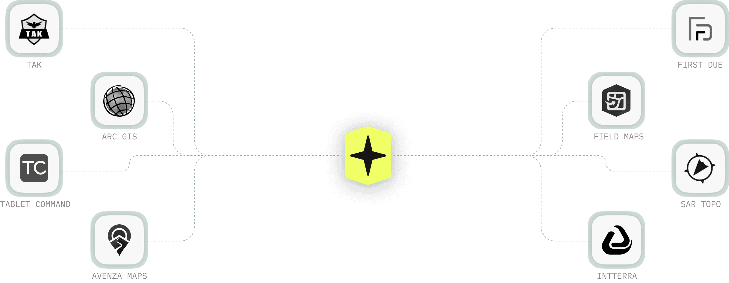
A Common Operating System
Contact our team to discuss integrations
Seamlessly integrate with your favorite tools
A Common
Operating System
Contact our team to discuss integrations
Seamlessly integrate with
your favorite tools
A Common Operating System
Contact our team to discuss integrations
Seamlessly integrate with your favorite tools
Book a 1:1 demo today
Craft the future. Respond to the present.
Book a 1:1 demo today
Craft the future. Respond to the present.
Book a 1:1 demo today
Craft the future. Respond to the present.
Contact
1-844-MAP-NOVA
© 2026 Novamaps Inc. ALL RIGHTS RESERVED.
Contact
1-844-MAP-NOVA
© 2026 Novamaps Inc. ALL RIGHTS RESERVED.
Contact
1-844-MAP-NOVA
© 2026 Novamaps Inc. ALL RIGHTS RESERVED.
Contact
1-844-MAP-NOVA
© 2026 Novamaps Inc. ALL RIGHTS RESERVED.