Back to blog
Sep 21, 2026
Case Study

For years, Anderson County Emergency Management Agency's drone footage lived in one place: the screen in the pilot's hands. Whatever a fire captain or search and rescue coordinator needed to know about the scene below had to travel from that screen to their ears, translated in real time over the radio. Every relay point was a chance for something to get lost.
Joseph Mead, the agency's director, runs a drone team that responds to wildland and brush fires, large structure fires, and search and rescue missions throughout the county. In those incidents, knowing what's ahead before committing people to the ground matters as much as knowing what's already happened. Before Nova, that meant standard line-of-sight flights, verbal size-ups over the radio, and thermal inspections with handheld or basic aerial cameras that produced raw footage with no way to map it.
Interpreting that footage took time the agency didn't always have. Thermal video is noisy by nature, and pulling an exact hot spot or a precise GPS coordinate out of it in real time wasn't fast or reliable. Relaying it up the chain, to the Emergency Operations Center or to mutual aid leadership, added another layer of lag before anyone off-scene had a clear picture.
Today, the same feed that used to end at the pilot's hands reaches Incident Command, county dispatch, and the EOC directly, streamed live and secured end to end. Off-site decision-makers get the same real-time picture as the person flying, without waiting for someone to describe it to them first.
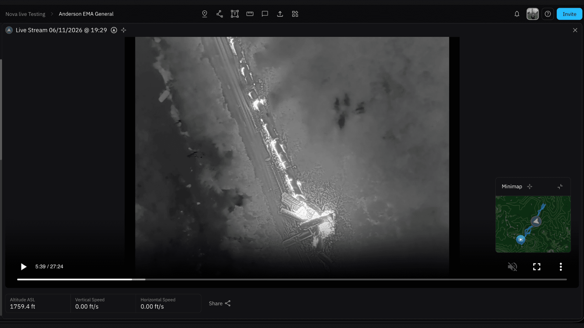
"By pairing real-time live streaming with hotspot mapping, it transforms raw aerial video into instant tactical intelligence," Mead said. That second half of the problem disappears before anyone even looks at the footage: flying a mapping pass over a target sector, Mead's team can filter out background solar heating and isolate active hot spots automatically, turning raw thermal footage into a precise, georeferenced map instead of a video someone has to interpret on the fly. "Instead of pilots trying to describe thermal anomalies over a radio, Incident Command and boots-on-the-ground crews see exact, georeferenced heat signatures in real time," he added.
Running both at once lets the agency work two levels of an incident simultaneously. "Combining live video streaming for high-level tactical oversight with automated thermal hotspot extraction allows us to run simultaneous strategic planning at Command while pushing precise, actionable targets down to boots-on-the-ground firefighters," Mead explained.
The agency has extended that same live-streaming setup to broader situational awareness and law enforcement collaboration, not just wildland fire response. Across incident types, the result has been faster decision-making at Command, less radio clutter, and less time spent searching rugged or low-visibility terrain for hot spots that used to be found by hand. "It removes the guesswork, speeds up decision-making, and directly keeps our emergency personnel safer and our command staff better informed," Mead said.
That's the shift underneath everything else. The relay points that used to lose information along the way are gone, and the pilot, Command, and the crews on the ground are now working from the same picture, at the same moment.
If a program like this could help your agency, our team is happy to walk you through what it would take. Book a demo or get in touch to explore next steps.
Start for free today.
Craft the future. Respond to the present.