Mapping Simplified.
With drag-and-drop map creation, seamless data integration, and collaborative map sharing, you can transform complex GIS data into mission-ready objectives. Creating maps should be as easy as creating a PowerPoint presentation—and now, it is. Our software enables you to effortlessly generate meaningful maps that empower you, your team, and your clients.
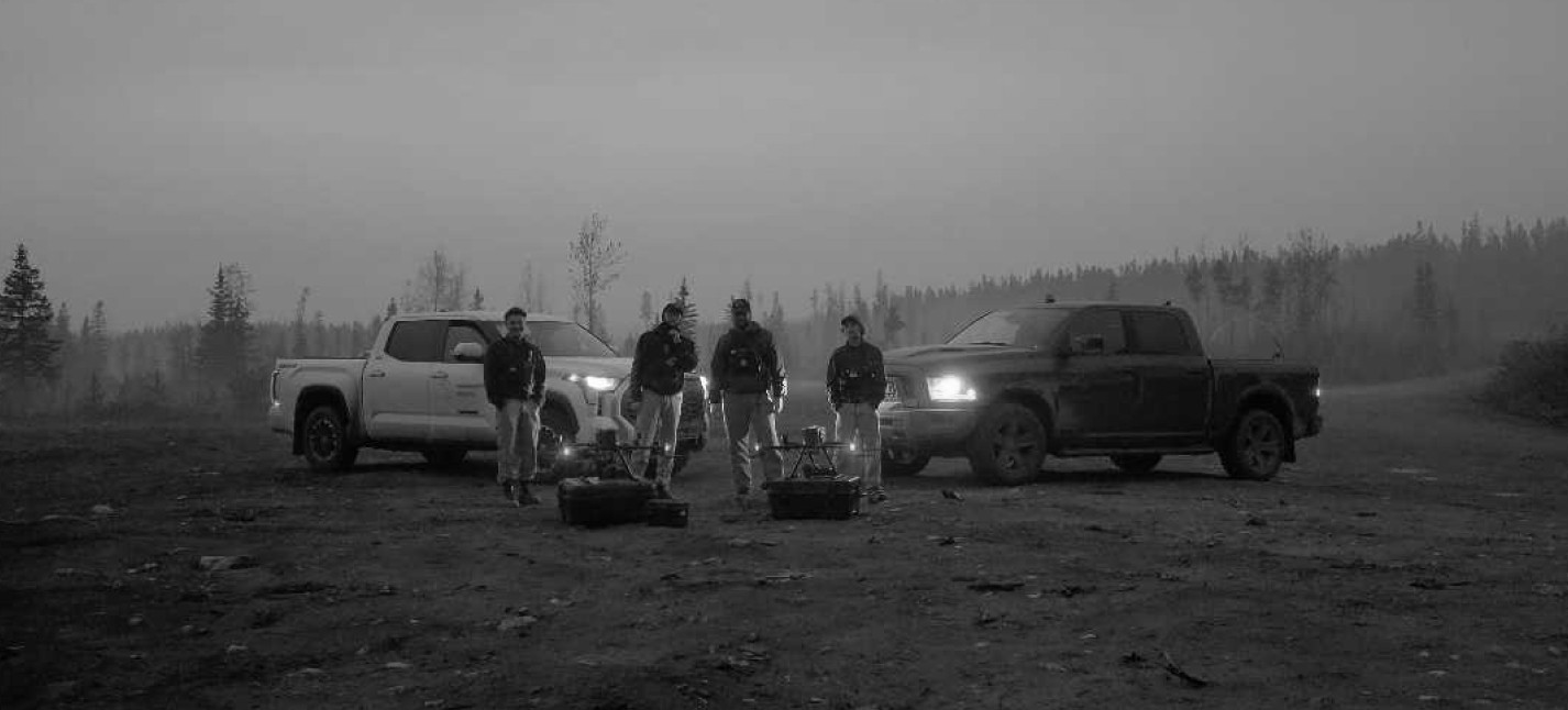
Designed for Drones.
Live stream, orthomosaics, video, thermal imagery—we make it simple. Our fast, intuitive, and reliable software simplifies complex data analysis, enabling you to process drone data with ease and enhance your team’s entire response.
TRUSTED BY


Build a unified, real-time common operating picture that keeps your team aligned. Whether responding to an emergency or planning long-term operations, stay up-to-date and keep everyone on the same page.
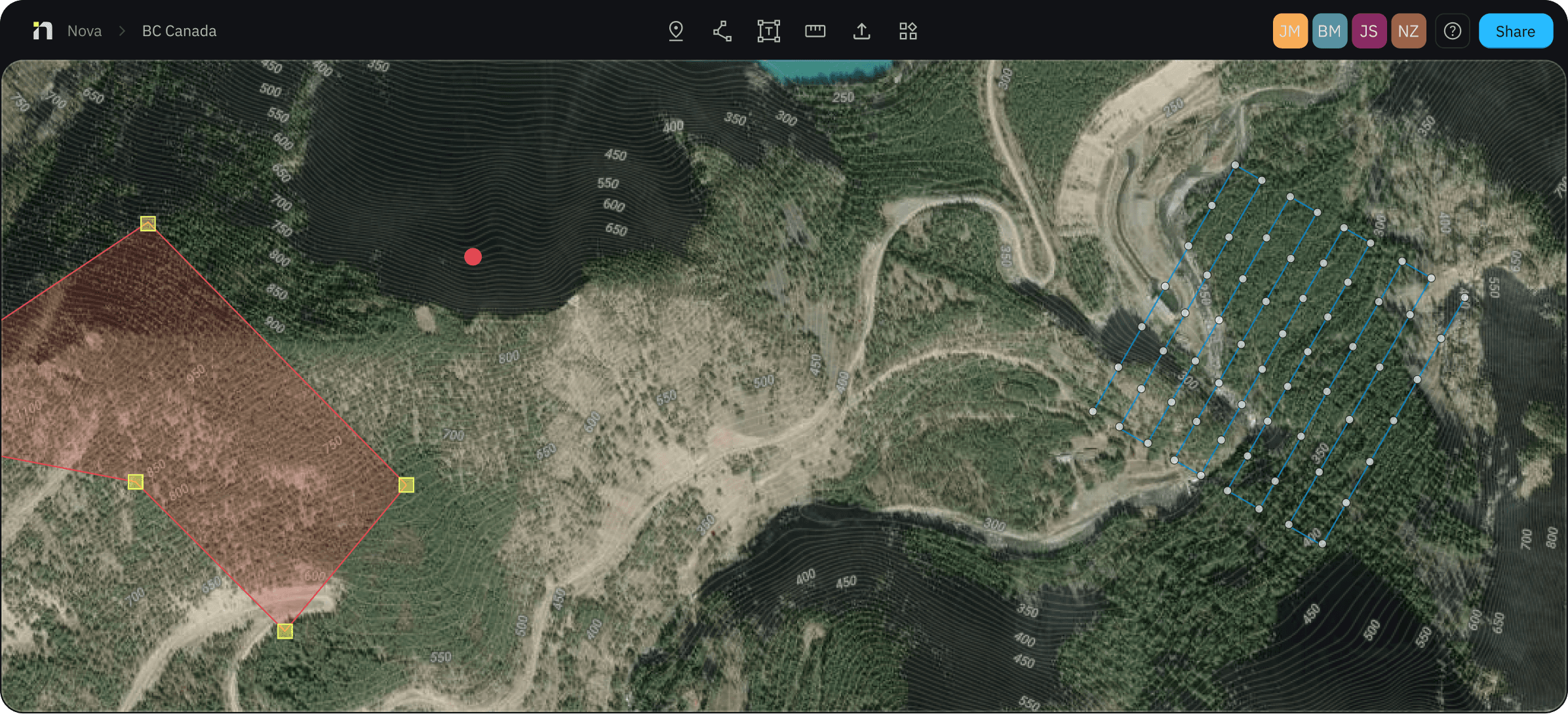

Our software adapts to your organization to tackle any mission with accuracy and confidence.


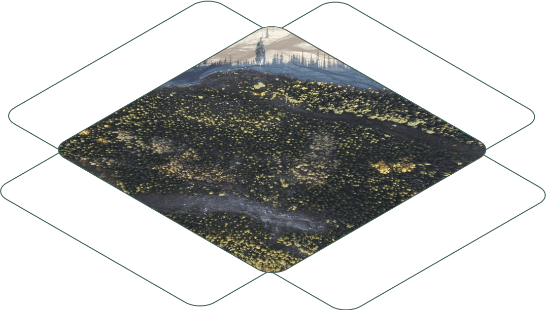


Fast, Accurate Orthomosaics
Quickly generate high-resolution orthomosaics and digital elevation models to support decision-making and landscape management. Deliver detailed maps ready for use by field crews, first responders, and GIS professionals—right when they need them.
Live Stream
See events unfold in real time with Live Stream. Share aerial footage instantly on any device—empowering decision-makers to act faster, make informed calls with confidence, and save valuable time.
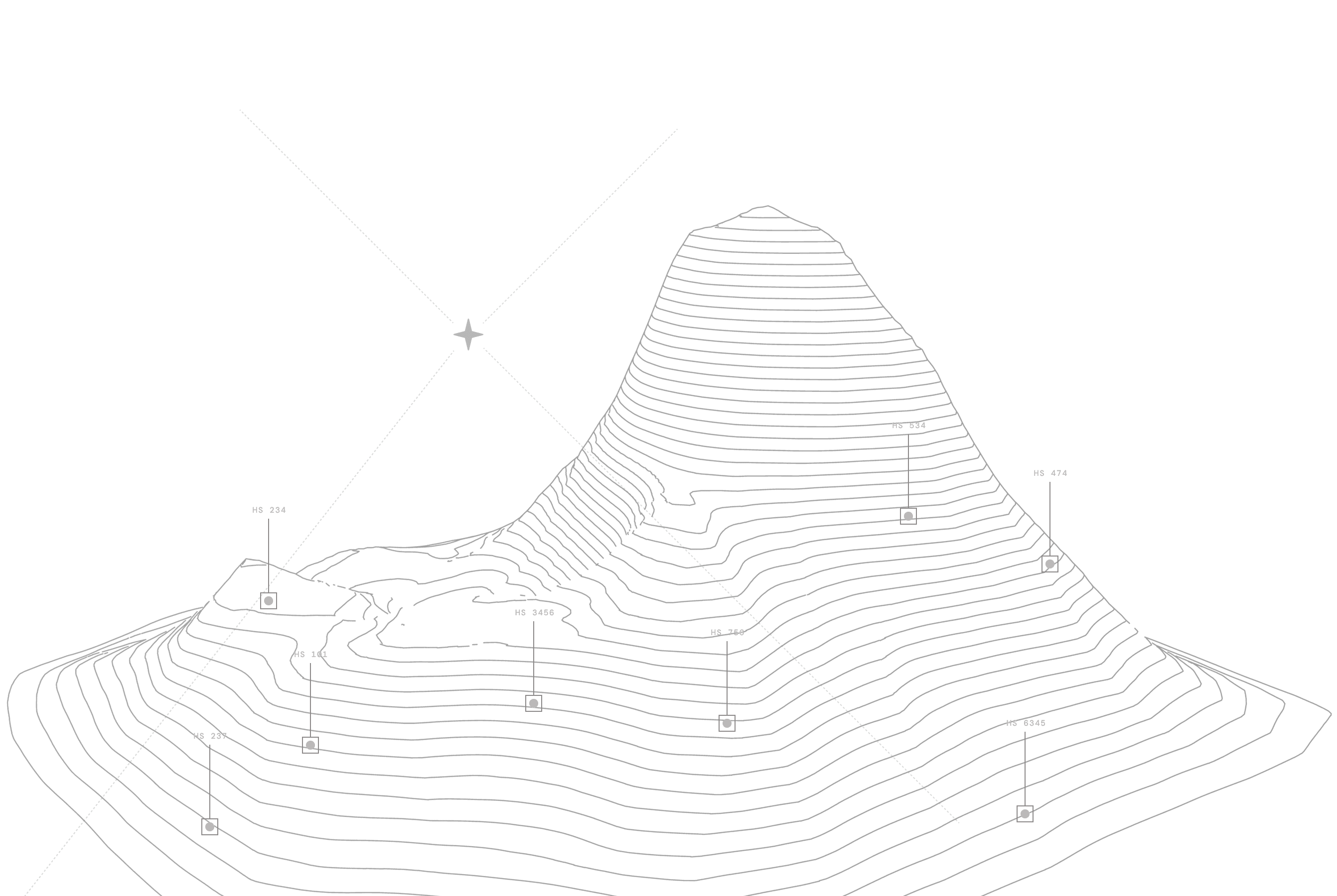
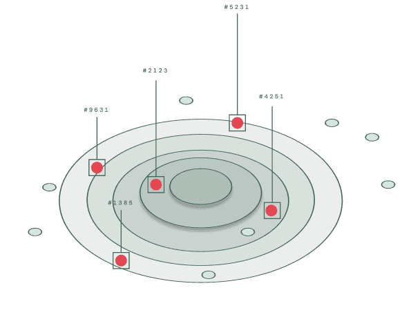
Automated Hotspot Detection
Powered by artificial intelligence, our hotspot model is changing how fires are managed and understood. Map fires in ways previously not possible. Whether you’re flying over wildland or structure fires, you can now call your fires out, with confidence.
Colorfinder
Identify color anomalies in an instant—like spotting a piece of clothing in a dense forest. Your drone footage becomes a powerful search & rescue detection tool with Colorfinder. It helps you focus search efforts, deploy teams efficiently, and save critical time when it matters most.
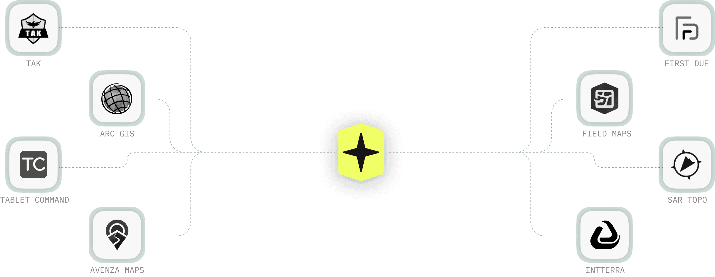
Generate PDFs & Layer Files
Generate professional, georeferenced PDF maps that empower your team to act quickly and confidently. Integrate with apps you already use, like Avenza and SAR Topo, and Team Awareness Kit (TAK), or export your layers into your preferred GIS platform—making information sharing and collaboration seamless.


Simple and predictable
pricing.
No hidden fees or credit purchases. Whether you're just getting started or are part of a team, we have a plan that's right for you.
“We just turned a 5 day fire into a 2 day fire cause the dudes on the engines had accurate hot spot maps to seek and destroy with.”

Josh Silveira
Cal Fire

Enterprise-grade security for everyone.
We safeguard your data with advanced encryption and secure storage. All information is encrypted in transit and at rest, and you choose whether it's stored in the U.S. or Canada. With continuous monitoring and 24/7 protection, your data stays safe—always.
SOC-2, Type-2
The gold standard in security compliance, we undergo rigorous independent audits to safeguard sensitive information, giving you the confidence that your data is protected with industry-leading security practices.
Access Controls
With robust access controls, only authorized users can access your sensitive data. Our role-based permissions and secure authentication maintain full control over who can view, edit, and manage your information.
An ecosystem to be a part of.
Get the latest news, articles, and resources sent to your inbox.
